« Back to Facilities Management News Home
« Facilities Management
3D Mapping System Geo-tags Indoor Assets
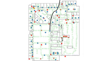
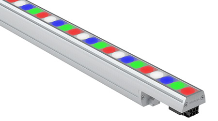
Indoor Reality's 3D mobile mapping solution has the capability to associate latitude longitude tags to assets, in GPS denied indoor environments. Unlike tripod based 3D mapping systems, Indoor Reality’s suite of mobile mapping systems have been capable of tagging assets either during acquisition, or post acquisition through the web interface. The feature automatically assigns a lat/long tag to indoor assets, a capability that traditionally has been available only to outdoor assets where GPS is readily available.
“The new feature takes asset tagging one step further by providing a unified location identifier for safety, security, energy, and IOT assets, not only inside one building, but also across multiple buildings across the globe. This in turn can be used by asset and facilities management solutions, and building automation systems to visualize, control, and manage assets seamlessly across multiple buildings. The location meta data is also critical for configuring building automation control and integrating sensor networks. It allows analytics applications to exploit spatial relationship between sensors and devices inside a building, to provide more comfort to the occupants, and to improve building energy efficiency. Furthermore, the geo-tagging information can be integrated with popular GIS software, unleashing the power of GIS software to building interiors,” according to founder and CEO, Dr. Avideh Zakhor.
More From 5/9/2019 on FacilitiesNet