« Return to FMDAA entries

Lee County (Fla.) Port Authority
CATEGORY: Financial Management
Overview

Creating an Airfield Marking Condition Assessment and Replacement Plan
The challenge to provide the organization’s leadership with precise cost estimates for large capital projects was put to the task in particular with one specific project that has extreme fluctuating expenses. It was imperative to develop a system that would accurately predict the cost to maintain Southwest Florida International Airport's Airfield Markings. These markings are designed to provide guidance to flight crews while operating at airports and are a critical component to the safe and efficient operation of an airport. They consist of four colors: red, white, yellow and black. The frequency at which these markings need to be repainted varies as a consequence of the climate in southwest Florida and their specific location. The FAA has very strict regulations detailing the specification for airfield markings; these regulations are codified in 49 U.S.C. Part 139 and additional guidance is provided in Advisory Circular 150 series.
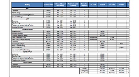
The variable frequency of this task creates a wave effect with higher costs in some fiscal years and lower costs in others. It was decided to build a predictive model that could accurately forecast the cost for any given fiscal year. The goal was to inform the executive leadership of anticipated costs years before the need arose. The Airfield Marking Predictive Replacement Plan was created by developing a database that contained the size (in square feet), color, installation date (or last repainting date) and location of all airport markings (about 2,000 individual markings). The next step was to develop a repainting frequency for each marking. By applying the repainting frequency to the installation or last repainting date, it could accurately predict when the marking would need to be repainted. The size of the marking multiplied by the current state contract repainting rate (adjusted for inflation in future years) developed a forecast cost for each marking. By applying the estimated cost in the forecasted replacement year, we could accurately predict the total cost of airfield marking repainting.
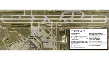
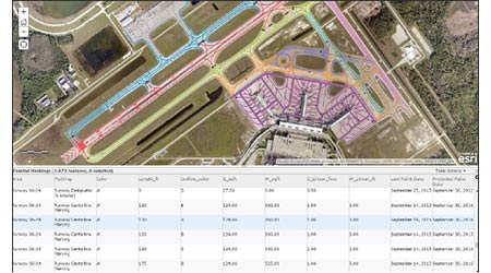
Maps were created as visual aids that would allow our executive leadership to quickly grasp the area that would be repainted. The next challenge was creating maps that would show the 885-acre area containing the airfield markings with enough resolution to actually highlight the markings; however, the manual process to create these maps was tedious and required a significant investment of time to update or change.
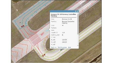
This was solved by utilizing a customized geographical information system (GIS). The information was uploaded from the existing database into the GIS, which allowed attributing data to each specific marking. The airfield marking GIS tool was a significant improvement over the original airfield marking prediction tool.
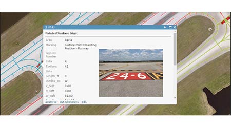
This GIS application is now available on mobile devices, allowing the personnel who inspect these markings, to quickly identify and report any discrepancies. It also permits people who maintain these markings to quickly find and correct the reported discrepancies. The system also has the capacity to store photographs of each marking.
This data allows the system to be utilized by many different employees within our organization. The application grants detailed analysis of the current conditions and to accurately predict future costs to maintain the markings. Additionally, this system grants for easy and efficient sharing of information, allowing the Maintenance Department to inform the airport stakeholders of what work can be expected. The practical application of the GIS has raised awareness within our organization of the technology and inspired others to seek out GIS-based solutions for many other Port Authority projects.
In-house Participants
Ethan Croop, Programs Manager
Scott Davis, Airfield/Grounds Manager
Nick Alexandrou, GIS Coordinator
↑ Back to top


